Manor Park
A post-war neighbourhood in Ottawa's east end, built from 1947 and bounded by the Cartier Parkway, the Aviation Parkway, Montréal Road and Birch Avenue.
* Ottawa Neighbourhood Study figures for its “Manor Park” area, which is larger than Manor Park alone.
Manor Park is a neighbourhood in Rideau-Rockcliffe Ward, in the east end of Ottawa, on the east side of Rockcliffe Park. The Ottawa Neighbourhood Study's 'Manor Park' area had 8,060 residents in the 2021 census.
Updated · Facts on this page link to their sources
About Manor Park
Manor Park is a neighbourhood in Rideau-Rockcliffe Ward, in the east end of Ottawa, on the east side of Rockcliffe Park. According to Wikipedia, it is almost exclusively residential, and most of its housing was built in the late 1940s and early 1950s by a consortium of five Ottawa-area developers. It was considered "Canada's first completely co-ordinated community". The Village of Cardinal Glen sub-neighbourhood was begun by Timberlay Homes in 1988. In the 2021 census, the ONS counts 8,060 residents and 4,350 private dwellings. About 52% of households rent, and apartments in buildings of five or more storeys make up 44% of dwellings.
Boundaries
Wikipedia describes Manor Park as bounded on the north by the Sir George-Étienne Cartier Parkway, on the east by the Aviation Parkway, on the south by Montréal Road and on the west by Birch Avenue. It lies on the east side of Rockcliffe Park, in Rideau-Rockcliffe Ward. The ONS draws its own Manor Park boundary (Gen 3), which the statistics here follow, so the two may not match exactly.
Homes
Wikipedia says the great majority of Manor Park's housing was built in the late 1940s and early 1950s, with the Cardinal Glen area added from 1988. In the 2021 census, the ONS counts 4,350 private dwellings. By type, 44% are apartments in buildings of five or more storeys, 26.9% row houses, 14.9% single-detached houses, 13.1% apartments in buildings under five storeys and 0.9% semi-detached houses. About 37.5% of dwellings are condominiums. 52.1% of households rent and 48.1% own. ons-sqo.ca en.wikipedia.org
- Built from 1947 and described by Wikipedia as Ottawa's first post-war subdivision
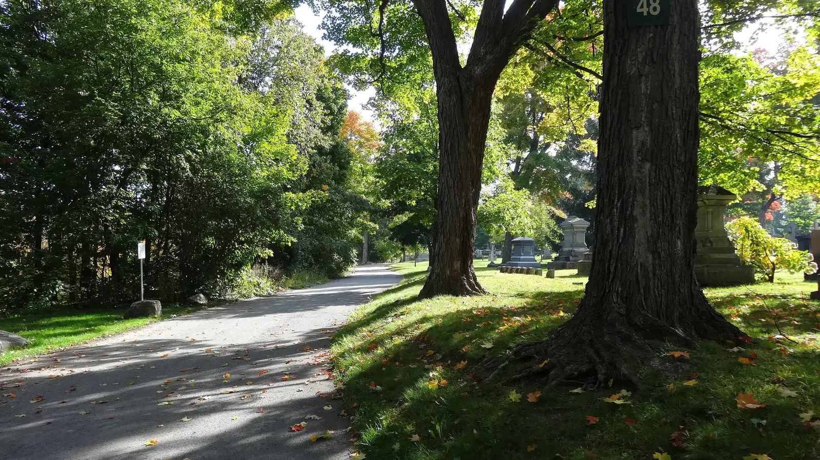
- Well treed, with some notable white pines (Wikipedia)
- Manor Park Public School (OCDSB) and Manor Park's park and ice rink share the Braemar Street site
- Homes are mixed: 44% apartments in buildings of 5+ storeys, 26.9% row houses and 14.9% single-detached (ONS, 2021)
- Parliament Hill is about 4.9 km in a straight line, or 6.2 km and 11 minutes by road with no traffic
- Farm Boy and Your Independent Grocer are on Montréal Road, and Hôpital Montfort is also listed there
Community
How Manor Park came to be
- 1920s
The first development in what is now Manor Park appeared in the mid-1920s and was known as Rockcliffe Annex. en.wikipedia.org
- 1947
After World War II, Manor Park was built over top of Rockcliffe Annex, becoming Ottawa's first post-war subdivision. The first families moved in in 1947. When it was built it was considered "Canada's first completely co-ordinated community". en.wikipedia.org
- 1950s
Most of the housing stock was built in the late 1940s and early 1950s by a consortium of five Ottawa-area developers. en.wikipedia.org
- 1988
The Village of Cardinal Glen sub-neighbourhood began to be built by Timberlay Homes. en.wikipedia.org
Before development, much of the land was slightly marshy, treed area used for riding trails stemming from nearby Mile Circle and by the Royal Canadian Mounted Police stables, which remain nearby and are home to the Musical Ride. en.wikipedia.org
Around Manor Park
Walking rings at 5, 10 and 15 minutes from the neighbourhood centre.
Schools
3 nearbyLe Cercle des savoirs
435 St-Laurent Boulevardopenstreetmap.org
380 m5 min walkManor Park Public School
OCDSB100 Braemar Streetopenstreetmap.org
400 m5 min walkSt-Laurent Academy
641 Sladen Avenueopenstreetmap.org st-laurentacademy.com
1.3 km17 min walk
Straight-line distances from the Manor Park centre. Living near a school does not guarantee a place: confirm the designated school for an address with each board. All schools and board locators.
Parks & places
10 nearbyAlvin Heights Park
352 London Terraceopenstreetmap.org
70 m1 min walkWading Pool - Alvin Heights
Swimming pool
349 Claremont Driveopenstreetmap.org
80 m1 min walkLondon Terrace Park
355 London Terraceopenstreetmap.org
100 m1 min walkHemlock Park
361 Meadow Park Placeopenstreetmap.org
210 m3 min walkManor Park
100 Braemar Streetopenstreetmap.org
440 m6 min walkManor Park Ice Rink
Ice rink
470 m6 min walkCardinal Glen Park
11 Dunbarton Courtopenstreetmap.org
580 m7 min walkRCMP Curling Club
Ice rink
115 St-Laurent Boulevardopenstreetmap.org
630 m8 min walkAnthony Vincent Park
14 A Bedford Crescentopenstreetmap.org
670 m8 min walkFuture Elsie McGill Park
750 m9 min walk
Shops & dining
4 nearbyBread & Roses Bakery
323 St-Laurent Boulevardopenstreetmap.org
70 m1 min walkOttawa Street Markets
560 m7 min walkFarm Boy
585 Montréal Roadopenstreetmap.org
990 m12 min walkYour Independent Grocer
596 Montréal Roadopenstreetmap.org
1.2 km16 min walk
Getting around
TransitTo downtown
Parliament Hill (downtown Ottawa) is 4.9 km in a straight line from the neighbourhood centre. By road it is 6.2 km, about 11 minutes (free-flow, no traffic). Routing is from the OSRM demo router on OpenStreetMap roads, as of 2026-10-30.
O-Train: St-Laurent station
1300 St-Laurent Boulevard. Open, per OpenStreetMap. It lies south of the neighbourhood.
O-Train: Cyrville station
1250 Cyrville Road. Open, per OpenStreetMap. It lies south-east of the neighbourhood.
O-Train: Tremblay station
170 Tremblay Road. Open, per OpenStreetMap. It lies south of the neighbourhood.
For sale in Manor Park
No Manor Park homes on manorpark.homes right now
Selling here? Get a website for your home, or browse every home for sale in the area.
Neighbouring areas
Quick answers
Short answers first; each links to the full answer and its sources.
Is Manor Park a good place to live?
Manor Park is a mostly residential east-end Ottawa neighbourhood in Rideau-Rockcliffe Ward. In the 2021 census it had 8,060 residents, a median age of 47.6 and 52.1% renter households. Its Ottawa Neighbourhood Study average Walk Score is 58.38, and Manor Park Public School is at 100 Braemar Street.
As of 2021 · ons-sqo.ca en.wikipedia.org
What schools serve Manor Park?
Manor Park Public School, at 100 Braemar Street, is an English-language elementary school run by the Ottawa-Carleton District School Board (OCDSB). Two other schools are also mapped nearby (board not confirmed): Le Cercle des savoirs (435 St-Laurent Boulevard) and St-Laurent Academy (641 Sladen Avenue).
As of 2026-10 · openstreetmap.org openstreetmap.org
How far is Manor Park from downtown Ottawa?
Parliament Hill is about 4.9 km in a straight line from the centre of Manor Park. By road it is about 6.2 km, or roughly 11 minutes in free-flowing traffic.
As of 2026-10 · router.project-osrm.org openstreetmap.org
What are homes like in Manor Park?
In the 2021 census, 44% of Manor Park's dwellings were apartments in buildings of five or more storeys and 26.9% were row houses. Single-detached houses made up 14.9%, apartments in buildings under five storeys 13.1% and semi-detached houses 0.9%. Condominiums were 37.5% of private dwellings.
As of 2021 · ons-sqo.ca en.wikipedia.org
What is the nearest O-Train station to Manor Park?
Of the three open O-Train stations in our data, St-Laurent station (1300 St-Laurent Boulevard) is the closest to Manor Park, at about 3.5 km straight-line from the neighbourhood centre. Cyrville station (1250 Cyrville Road) and Tremblay station (170 Tremblay Road) are also mapped to the south.
As of 2026-10 · openstreetmap.org openstreetmap.org
Where do people in Manor Park buy groceries?
Two supermarkets sit on Montréal Road along the neighbourhood's southern edge: Farm Boy (585 Montréal Road) and Your Independent Grocer (596 Montréal Road). They are roughly 1.0 km and 1.25 km straight-line from the neighbourhood centre. Ottawa Street Markets is mapped as a grocery just north of the centre, and Bread & Roses Bakery is at 323 St-Laurent Boulevard.
As of 2026-10 · openstreetmap.org openstreetmap.org